Create PDF Winter Spreading Map |

|

|
|
Create PDF Winter Spreading Map |
|
|
Create PDF Winter Spreading Map |
|
|
|
Create PDF Winter Spreading Map |
|
|
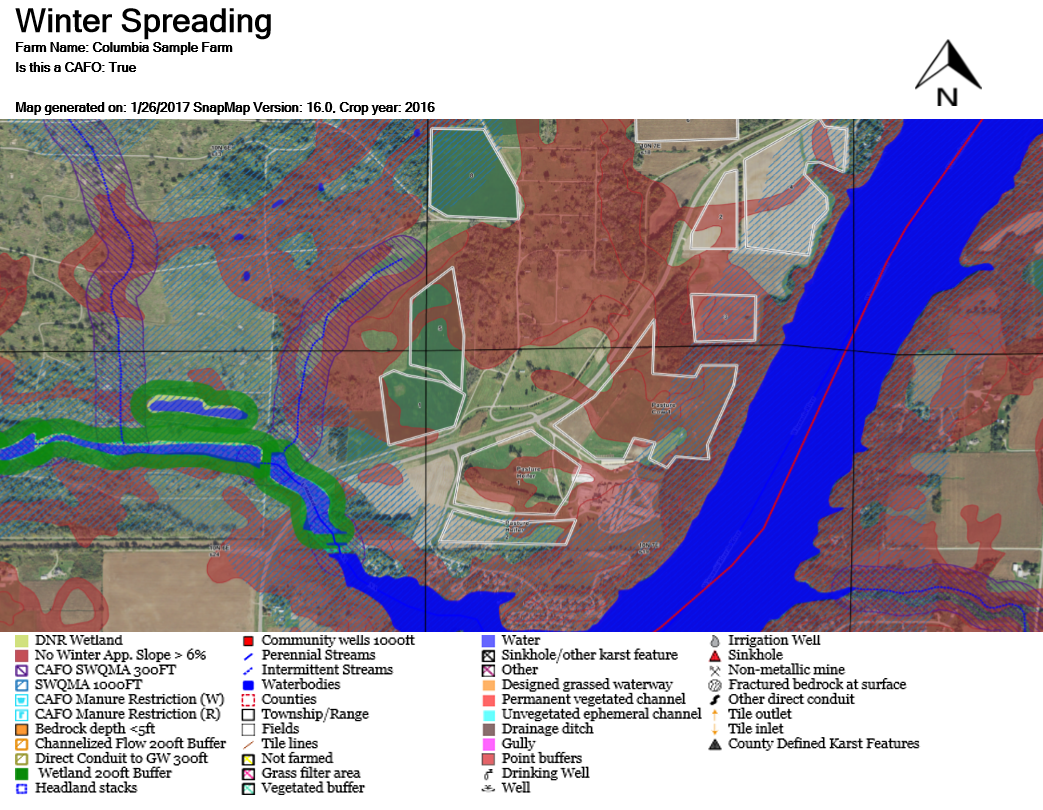
The Create PDF Winter Spreading Map tool (only available if your farm is a CAFO) is used to generate a PDF with the appropriate layers for determining winter spreading. Begin by navigating to the part of your farm you want to show on the PDF. See Map Navigation for more information. Everything on screen (including anything obscured by the Layers sidebar) will be included in the PDF. Use ![]() or
or ![]() to collapse the Layers sidebar. Select the layers you want to show in the PDF and make sure they load fully. If you do not wait, the PDF may come out fuzzier than you would like. Note: The map on the PDF will be scaled to a 5:3 ratio (width:height). If the image on your PDF appears stretched, try resizing the window to a different shape when you make the PDF.
to collapse the Layers sidebar. Select the layers you want to show in the PDF and make sure they load fully. If you do not wait, the PDF may come out fuzzier than you would like. Note: The map on the PDF will be scaled to a 5:3 ratio (width:height). If the image on your PDF appears stretched, try resizing the window to a different shape when you make the PDF.
Now go to PDF Creation | Create PDF Winter Spreading Map. This will generate the PDF and open it in a pop-up (which often appears as a new tab). Note: Most browsers block pop-ups by default. For instructions detailing how to enable the pop-ups, got to the Enabling Pop-ups section.
If you would like print the PDF you can do so through your browser by pressing Ctrl + P, by going to File | Print in your browsers menu, or by clicking the print icon in your browser's PDF control panel. If you would like to save the PDF, follow the instructions here, Saving a PDF.