SnapMap Acres Tab |

|

|
|
SnapMap Acres Tab |
|
|
SnapMap Acres Tab |
|
|
|
SnapMap Acres Tab |
|
|
If the farm is not a CAFO the SnapMap Acres tab shows two acre values for each field.
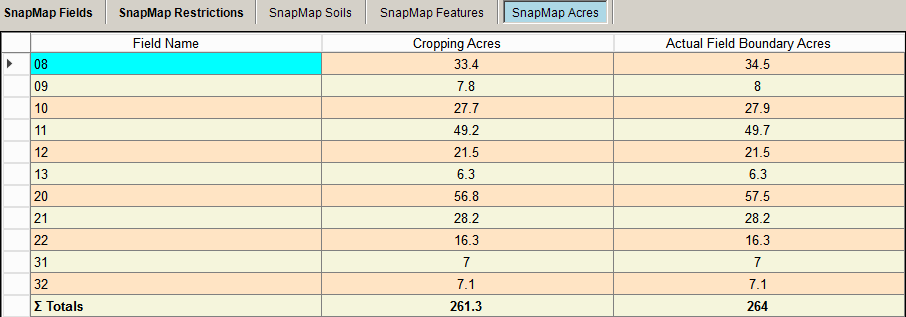
Column Meanings
•Field Name: The field name from the fields tab.
•Cropping Acres:the total acres minus any water and exclusion areas
•Actual Field Boundary Acres: The total acres inside the field boundary.
If the farm is a CAFO you’ll see the additional columns related to manure spreading restrictions.
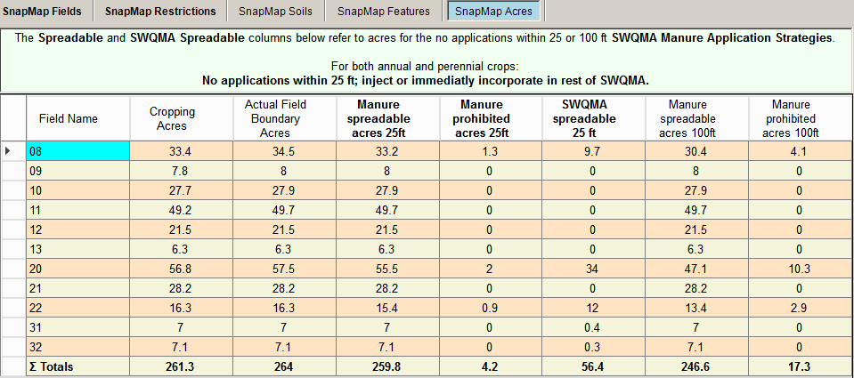
The text, above the grid, reflects the SWQMA Manure Application Spreading Strategies selected for annual and perennial crops on the Farms Screen.
Additional Column Meanings
•Manure spreadable acres 25 ft: Acres that may receive manure outside the 25 ft spreading restricted features.
•Manure prohibited acres 25 ft: Acres that can not receive manure within 25 ft of restricted spreading features.
•SWQMA spreadable 25 ft: Acres within a SWQMA that may receive manure outside the 25 ft spreading restricted features.
•Manure spreadable acres 100 ft: Acres that may receive manure outside the 100 ft spreading restricted features - based on SWQMA manure application strategy.
•Manure prohibited acres 100 ft: Acres that can not receive manure within 100 ft of restricted spreading features - based on SWQMA manure application strategy.