SnapMap Restrictions Tab |

|

|
|
SnapMap Restrictions Tab |
|
|
SnapMap Restrictions Tab |
|
|
|
SnapMap Restrictions Tab |
|
|
The SnapMap Restrictions tab displays the restrictions for each field. This is where you import the restrictions into SnapPlus. See Importing Data into SnapPlus for more information. The Restriction column gives a short description of the restriction. The Percent column displays one of two things depending on the origin of the restriction. If the restriction was caused by a point feature, then the Percent is the percentage of the buffer around the point feature that is covered. If the restriction was caused by a SWQMA, slope, or Fall N Restriction then the Percent is the percentage of the field covered by the restriction.
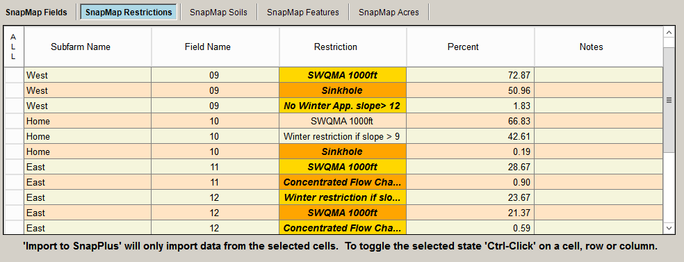
•Subfarm Name: The subfarm of the field which this restriction applies to. •Field Name: The name of the field which this restriction applies to. •Restriction: A short description of the restriction. •Percent: If the restriction was caused by a SWQMA or a Fall N Restriction this is the percentage of the field covered by the restriction. If the restriction was caused by a point feature, then this is the percentage of the buffer around the point feature. •Notes: Additional information about the restriction. This may be filled in by SnapPlus or you. |