Import a Point Shapefile |

|

|
|
Import a Point Shapefile |
|
|
Import a Point Shapefile |
|
|
|
Import a Point Shapefile |
|
|
To import point features such as wells, simply zip up the shapefile with the points. These four files need to be included: .shp, .shx, .dbf, and .prj, e.g. mypoints.shp, mypoints.shx, mypoints.dbf, and mypoints.prj. All four files must be present, and they need to be put into a ZIP archive to be uploaded. (If your GIS software produces more than these four files, that won’t hurt anything.) Now click Drawing Tools | Import a Point Shapefile. Browse to your point zip file. Select it and click Open.The following box will appear:
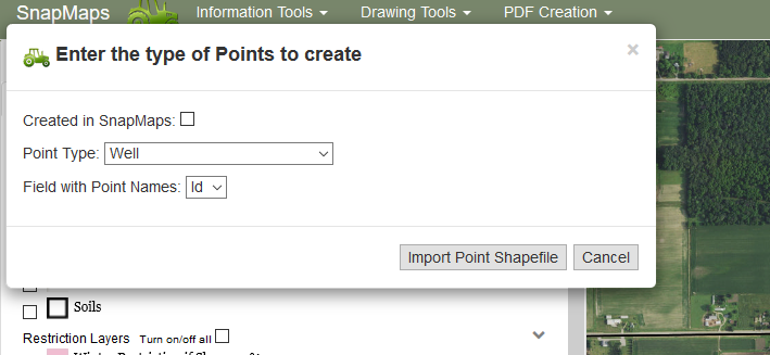
If this shapefile was created in SnapMaps simply click the check-box, Created in SnapMaps, then click Import point shapefile and your done. If it was not created in SnapMaps, select from the dropdown the type of points and the field that has the point names. Click Import Point Shapefile. You points will be loaded in. Shapefiles from the DATCP 590 site can be directly imported into SnapMaps using this tool. You can import point shapefiles exported from the DATCP 590 site (Markup | Extract Markup | Save as Shapefile); the points will be imported, but not their text labels.